The best hikes in Spain are in the Picos de Europa and the Pyrenees between June and September. In winter, many high altitude trails there are under snow, and hiking in Spain is better further south and east. The Caminito del Rey near Málaga and Puig Campana behind Benidorm both make good winter walks, as does Montserrat near Barcelona.
What are some popular hiking trails in Spain?
Popular hiking trails in Spain include the Cares Gorge in the Picos de Europa and the Caminito del Rey near Málaga. Part of the Cares Gorge path has been closed for repairs since 16 October 2026, and there’s more about the closure in the Cares Gorge section below. We’ve included both, alongside quieter routes like the Lagos de Saliencia in Somiedo. Here are the ten trails we’d recommend.
Difficulty Key
Easy means under 10km and under 400m of climbing, on a clear path. Moderate means up to 20km or 900m of climbing in a day. Hard means more than that, a summit above 3,000m, or steep, rough ground. Multi-day routes are graded by a typical day.
These ten routes cover four parts of Spain. In the north, you’ll find the Lagos de Saliencia and the Cares Gorge in the Cantabrian Mountains, with Ordesa further east in the Pyrenees. The Caminito del Rey and Mulhacén are both in Andalucía.
Peñalara is north of Madrid and Sant Jeroni is near Barcelona. Puig Campana is the mountain behind Benidorm, and the GR221 and Mount Teide are on Mallorca and Tenerife. If you’re combining routes, pick ones in the same region to avoid long drives. There’s more about driving in Spain, including tolls and licences, in our guide to planning a road trip in Europe.
TripJuggler Tip
Saving YouTube hiking videos for your trip? Paste the links into a TripJuggler Trip Board, and we’ll pull out the trails and places from each one.
Disclaimer
All route details and booking rules in this guide are correct as of October 2026, but they do change. Trails can also close at short notice because of snow or seasonal access rules. We update this article regularly and would recommend checking the Caminito del Rey official website and Spain’s National Parks Network the day before you go.
Where’s the best hiking in southern Spain?
The best hiking in southern Spain is in Andalucía, and we’ve picked our two favourite routes there. The Caminito del Rey was once called the most dangerous path in the world. Today it’s a wooden walkway bolted to the rock of a gorge, with a hanging bridge across it. Our second pick is Mulhacén, the highest mountain on mainland Spain, and from the top you can sometimes see across the sea to the mountains of Morocco.
Caminito del Rey
The Caminito del Rey hike is a 7.7km one-way walk through the Gaitanes Gorge in Málaga province, and nearly 3km of it is on boardwalks. A second suspension bridge opened near the end in June 2026, and it’s 110m long and 50 metres above the gorge.
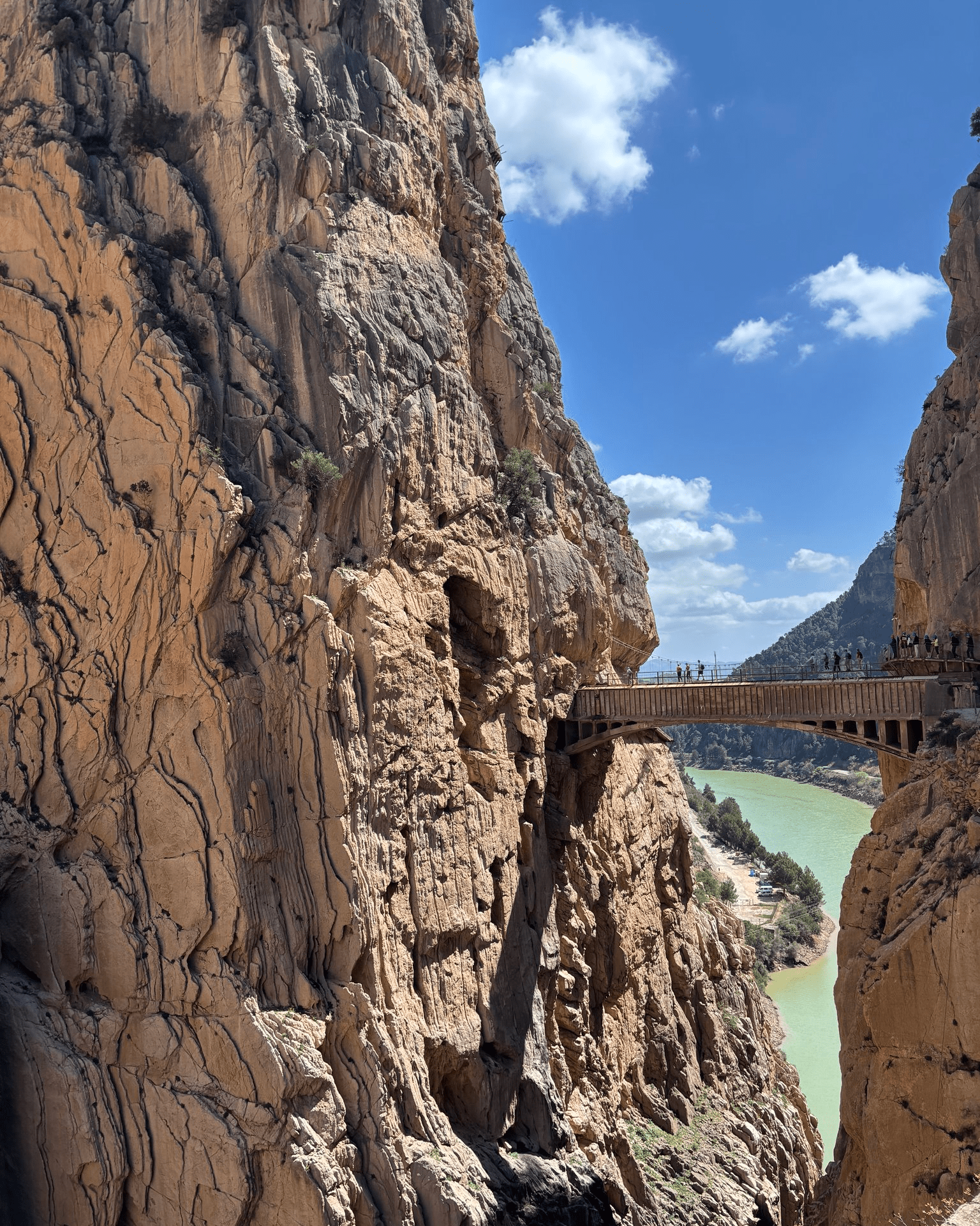
We booked the official guided tour in English on the Caminito del Rey website, and our guide was incredibly knowledgeable about the geology of the gorge and its wildlife. We were taken through the gorge very slowly, and sometimes had to wait for the group in front of us. It was beautiful, but it only took about two hours and felt more like a relaxed walk than a hike. We wished the trail was longer!
Tickets often sell out, so it’s safest to book on the official Caminito del Rey website well in advance. The ticket office at the north entrance only sells them on the day if there are spaces left.
TripJuggler Tip
Park at the Visitor Reception Centre, where the shuttle bus to the start leaves from, at least an hour before your time slot.
Mulhacén
The Mulhacén hike starts at the Paraje del Cascajar, a stop at 2,574 metres that’s reached by park minibus from the village of Capileira. The summit is 3,479 metres high.
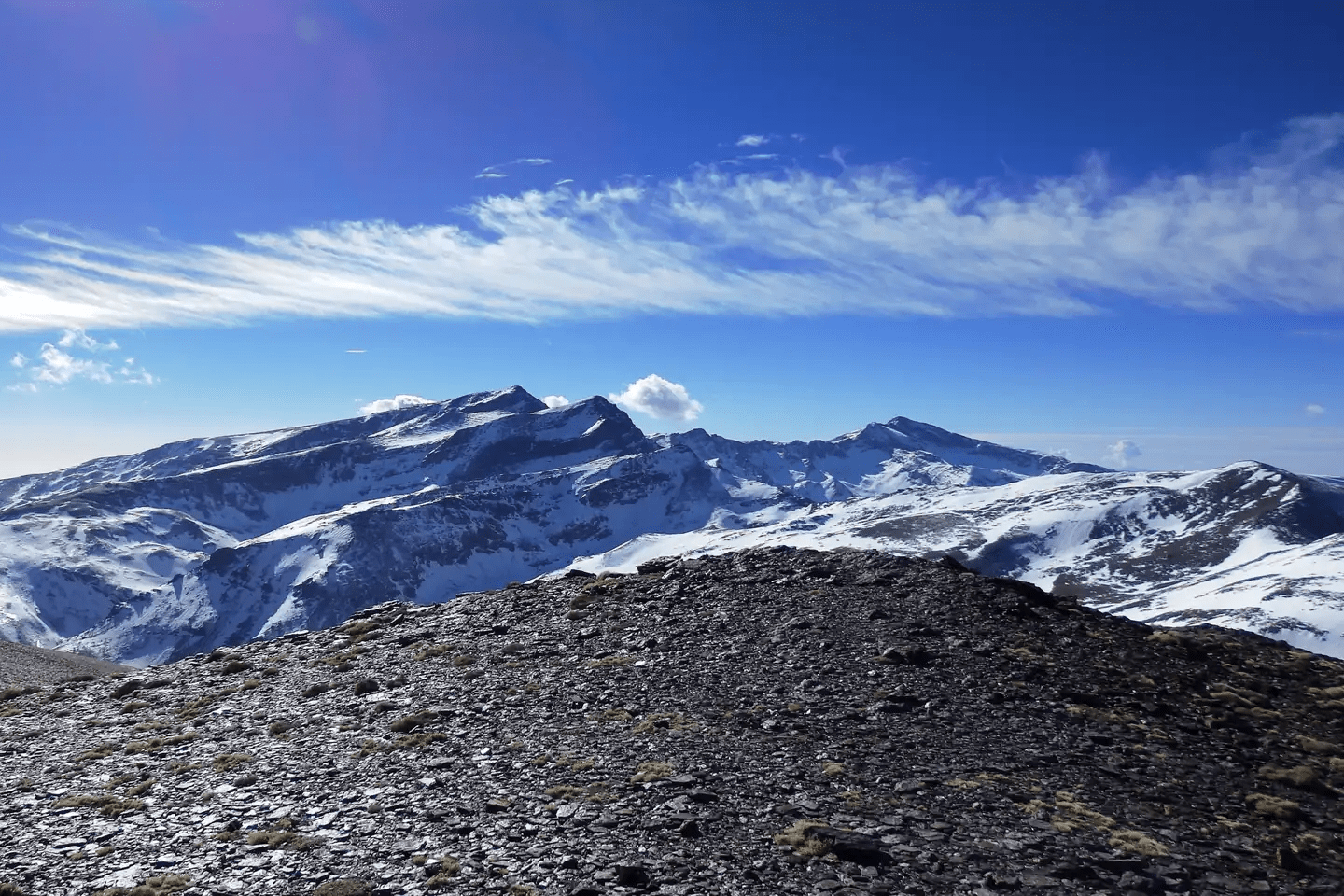
The walk begins on a gravel road as far as the Alto del Chorrillo at 2,700 metres, and from there the path is narrow and stony up the southern side of the mountain. It’s a there-and-back walk, with the same route up and down. We’ve written everything you need to know about the minibus, and longer routes from Hoya del Portillo and Trevélez, in our guide to hiking in Sierra Nevada.
From the top, there are views across the Sierra Nevada to Pico Veleta, the second-tallest peak in the range. Looking down the mountain’s eastern side, you can see Siete Lagunas, a valley of small glacial lakes.
Mulhacén is a high-altitude walk, and it’s common to feel breathless or get a mild headache near the top. Take it slowly, and turn back if you start to feel unwell.
Where are the best hikes in the north of Spain?
The best hikes in the north of Spain are in the Cantabrian Mountains and the Pyrenees. We’ve picked out our three favourites from these regions. The first is the Lagos de Saliencia loop in Somiedo, the best place in Spain to spot wild brown bears. The second is the Cares Gorge, which has tunnels through the rock and bridges over the river. The third is the climb to Monte Perdido, which includes a night in a mountain refuge. From the summit, you can look down on one of the last glaciers in Spain.
Lagos de Saliencia
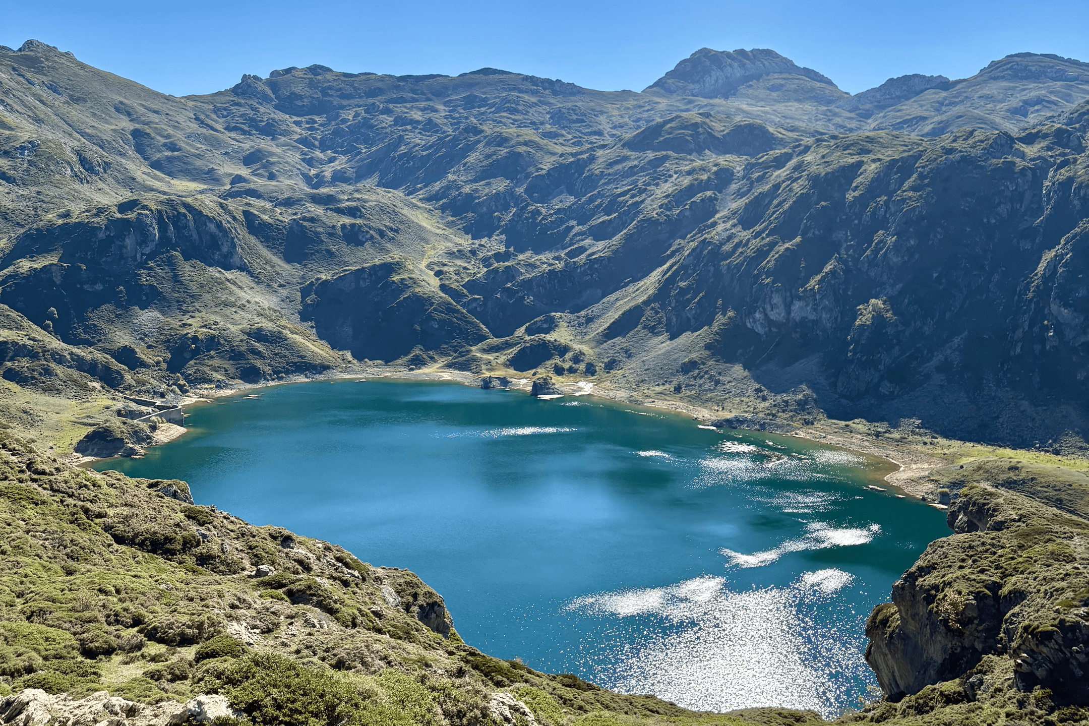
The Lagos de Saliencia hike is a 7.6km circular walk past four glacial lakes in Somiedo Natural Park, Asturias, and it’s one of our favourite walks in Spain. When we were planning our trip to Asturias, we picked it over the better-known Lagos de Covadonga in the Picos de Europa, because lots of people said it was quieter and even more beautiful.
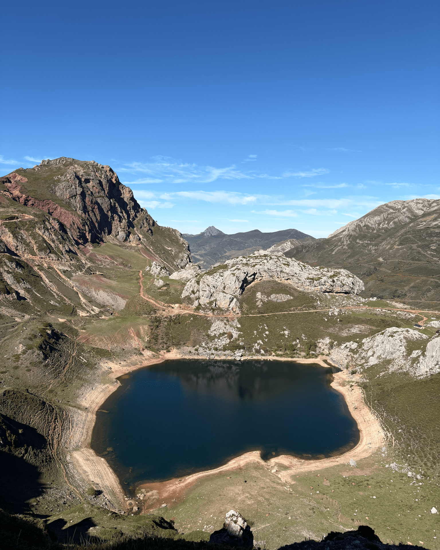
We drove from Oviedo to the free car park at the Alto de la Farrapona, the trailhead for the Lagos de Saliencia, taking the mountain roads instead of the motorway. The drive was beautiful, but there were quite a few sketchy bends. The pass is 1,708 metres up, on the border between Asturias and León. The first part of the loop is a little steep, and so is the way back down, but the rest is gentle. It only took us about two hours.
Lago Calabazosa, also called Lago Negro, is the third lake and the largest of the four. It covers 17 hectares, about the size of 24 football pitches. We didn’t spot any of Somiedo’s bears, but there were plenty of cows grazing near the lakes.
TripJuggler Tip
The loop follows the PR-AS 15 path, which is marked with white and yellow stripes, and we found it easy to follow without a downloaded map.
Cares Gorge
Closure update, 27 October 2026
Part of the Cares Gorge path has been closed since 16 October 2026 while two bridges are repaired, and there’s no reopening date yet. You can still walk part of the way from either end and come back the same way.
The Cares Gorge hike is an 11km path through the gorge of the River Cares in the Picos de Europa National Park, between the villages of Poncebos in Asturias and Caín in León. In Spain, it’s known as the Ruta del Cares, and it’s the most popular walk in the Picos de Europa. The gorge itself is nicknamed the Divine Gorge.
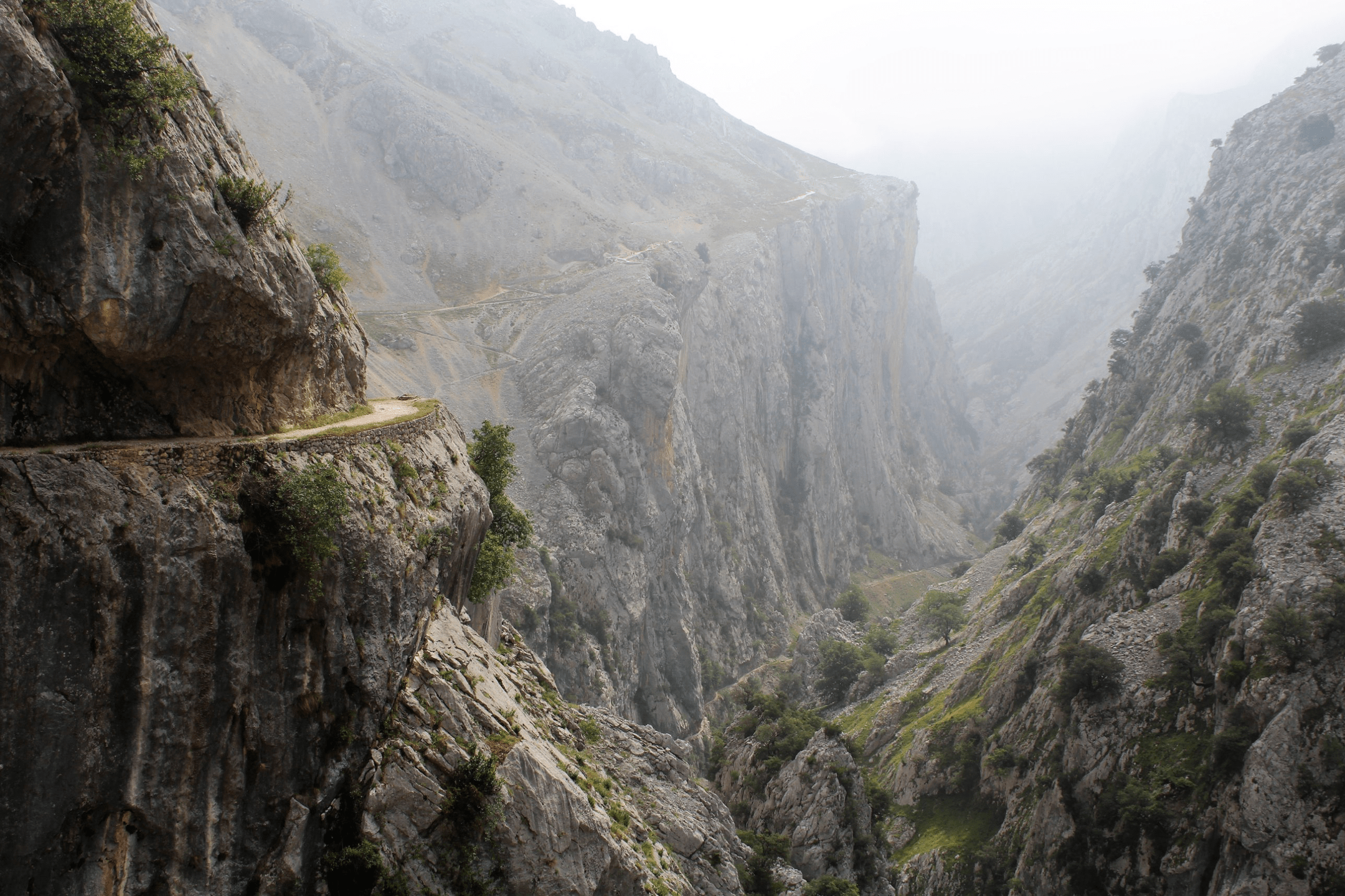
It’s usually walked there and back from Poncebos, which makes 22km in total. The first 2km from Poncebos are the steepest, with about 300 metres of climbing, and after that the path is fairly level all the way to Caín.
The path is a ledge carved into the side of the gorge, with the River Cares below. Caín, at the far end, is a village of fewer than 60 people with a few bars and restaurants, and it’s a great place to stop for lunch before walking back.
The path itself is simple to follow, and the main challenge is the distance. Parts of it have no railing on the river side, which can feel unnerving for anyone who isn’t keen on heights. The park sometimes closes the path for a day or two after a rockfall, and reopens it once the cliffs have been checked.
Ordesa Valley to Monte Perdido
The Ordesa Valley to Monte Perdido hike is a two-day climb in Ordesa y Monte Perdido National Park, in the Spanish Pyrenees. The hike starts at the Pradera de Ordesa, a meadow at the bottom of the Ordesa Valley, and the summit of Monte Perdido is 3,355 metres high.
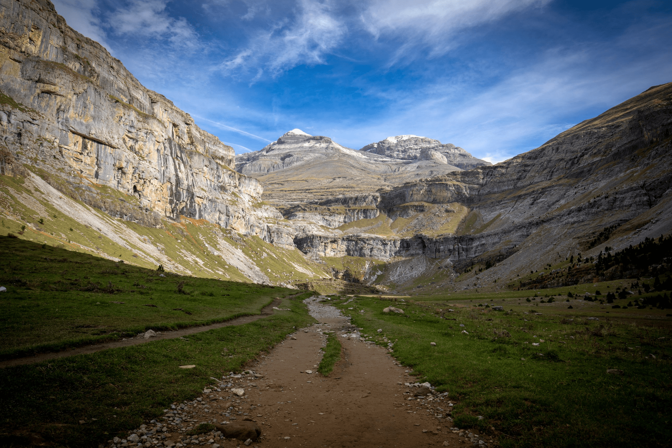
In summer, at Easter, and during other holidays, the road up to the Pradera is closed, so you’ll need to take the Ordesa bus from the village of Torla.
On the first day, the walk up the Ordesa Valley is 11.5km, through beech and fir forest and past several waterfalls. After the last waterfall, the Cola de Caballo, the climb is very steep until you reach the Góriz refuge at 2,200 metres. It’s a staffed mountain hut with shared bunk rooms, where you can also book dinner and breakfast.
Day two is longer, at about 20km, because it combines the climb from the refuge to the summit, and the walk back down to the Pradera. The last part of the climb is La Escupidera, the steep slope of loose stones before the summit. It often has snow or ice on it in June, and again after the first snow in autumn, and in those conditions that part of the climb is better suited to experienced hikers.
TripJuggler Tip
Book the Góriz refuge well ahead, as it’s usually full in summer.
Where can you hike in central and eastern Spain?
In central and eastern Spain, the best hiking is in the Sierra de Guadarrama north of Madrid and in the mountains near Barcelona and Benidorm. Our three favourites are all day trips from a city, which makes them easy to fit into a city break. Peñalara is the tallest of the Madrid mountains, a little over an hour’s drive north of the city. Montserrat is a 90-minute train journey from Barcelona. It’s a mountain of rounded rock towers, with a monastery built into its side. From the summit of Puig Campana, above Benidorm, you can look out over the town’s skyscrapers to the sea.
Sierra de Guadarrama (Peñalara)
The Peñalara hike is a 14km circular walk in the Sierra de Guadarrama National Park, over the 2,428-metre summit of Peñalara and back past its glacial lakes.
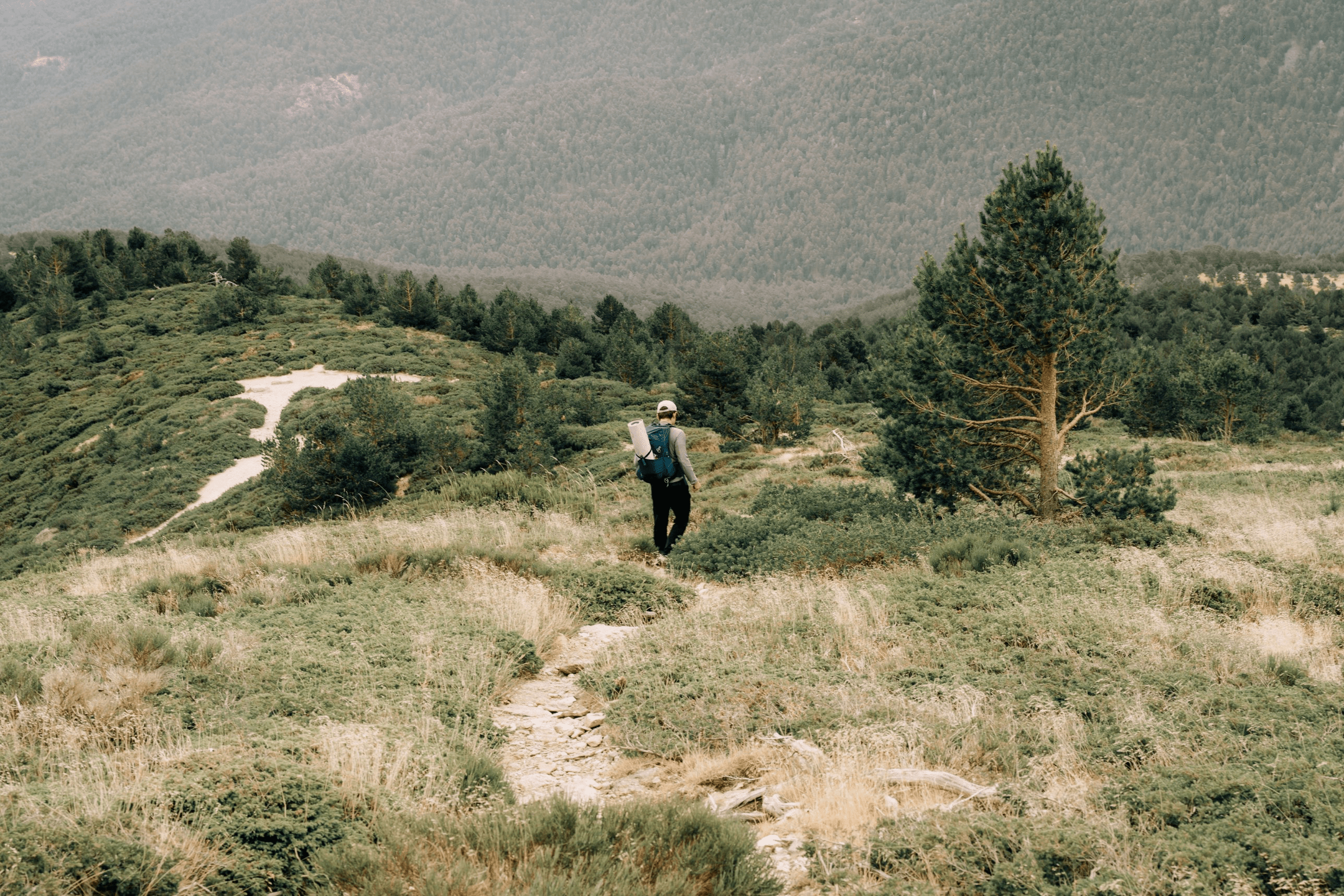
You’ll set off from the Peñalara Visitor Centre at Puerto de Cotos, a mountain pass on the border between Madrid and Segovia, and finish back there at the end of the loop. The first part is a forest track through pine trees, followed by a zigzagging path up to two lower peaks, Hermana Menor and Hermana Mayor. From there, it’s a short climb along the ridge to the summit.
After the summit, the hardest part of the walk is the Risco de los Claveles, a narrow, rocky ridge with steep drops. On the way down, you’ll walk past several small glacial lakes, including a group called the Cinco Lagunas, or Five Lakes. Before heading back to the visitor centre, you can also take a short detour to the Laguna Grande de Peñalara, the largest of the lakes on Peñalara.
There’s a limit of 945 walkers a day on Peñalara, and you’ll need to check there’s space at the visitor centre before you start.
TripJuggler Tip
On weekends, arrive in the morning, because once the daily limit is reached, no one else is allowed on until the next day.
Montserrat
Hiking Montserrat to Sant Jeroni, its tallest peak, is an 11km circular walk from the monastery in Montserrat Natural Park.
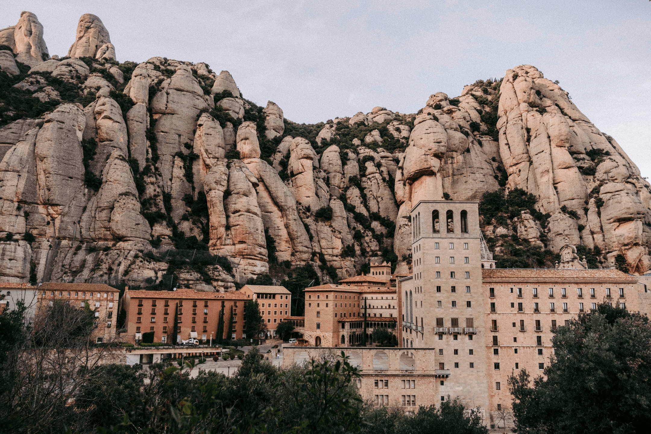
From the square outside the monastery, the first part of the walk is a long climb up stone steps on the Camí Vell, the old path to Sant Jeroni. Partway up, you’ll squeeze through a narrow gap between two rocks called the Pas dels Francesos. After that, the climb is gentler through oak woods until you reach the small chapel of Sant Jeroni, and from there it’s about a hundred steps up to the summit at 1,236 metres. From the top, you can see as far as the Pyrenees, and in very clear weather, even Mallorca.
The way back is on a flatter path, the Camí Nou, to the top station of the Sant Joan funicular, a mountain railway that runs up from the monastery. From there, you can walk the rest of the way down on a wide track, or take the funicular.
TripJuggler Tip
If you’d like an easier walk, take the Sant Joan funicular up from the monastery first, and you’ll skip about half the climb.
Puig Campana
The Puig Campana hike is a 16km circular walk around and over Puig Campana, the mountain behind Benidorm, from the Font del Molí in the village of Finestrat. At 1,406 metres, it’s the best known of the Benidorm mountains, with a deep notch in its ridge that you can see from the coast.
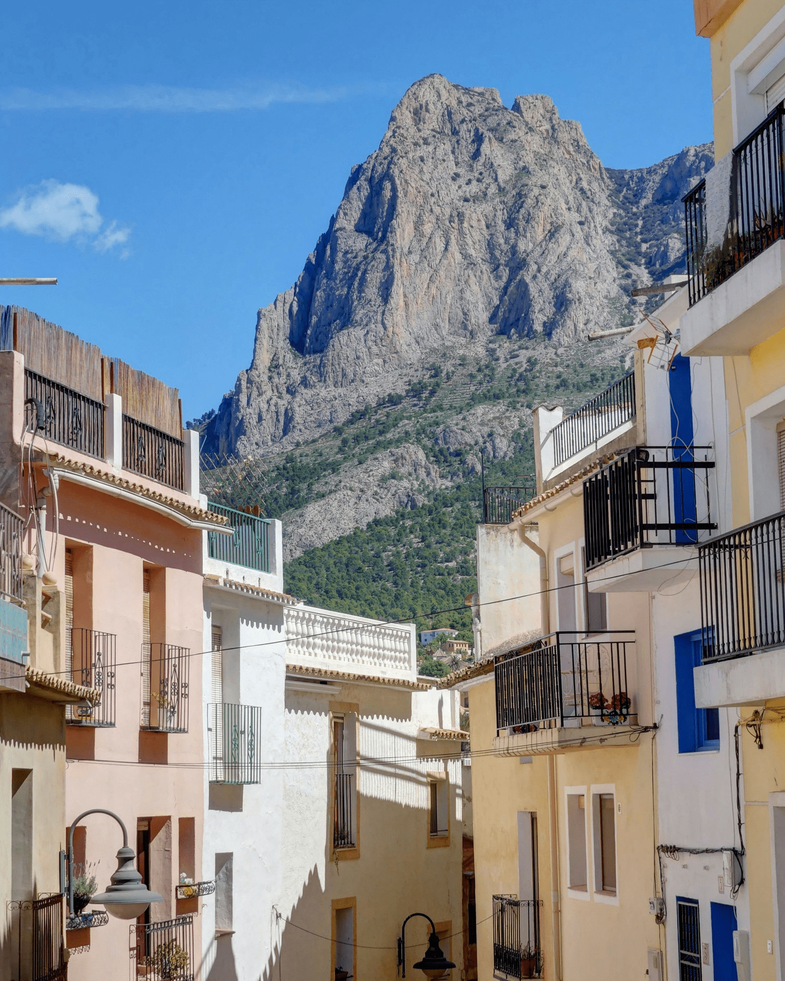
The Font del Molí is a spring with thirteen spouts and a car park, and it’s a good place to fill your water bottles before setting off. For the first 5km or so, you’ll walk round the west side of the mountain and then up a forest track to a pass called the Coll del Pouet.
From the pass, the summit is a there-and-back climb of about 500 metres. It’s very steep, with loose stones underfoot, until you reach a flatter terrace called the Bancal del Moro. From there it’s a much easier walk to the top.
Back at the pass, you’ll carry on round the east side of the mountain, and after one steep, rocky descent, it’s a gentler walk back to the Font del Molí.
TripJuggler Tip
Download the route before you go, as there are gaps in the waymarks and some unofficial paths near the summit.
Which Spanish islands are best for hiking?
The best Spanish islands for hiking are Mallorca and Tenerife, and we’ve picked our favourite walk in each. In Mallorca, the GR221 is a long-distance path across the Serra de Tramuntana, on old mountain tracks built with dry stone. The mountain range is a UNESCO World Heritage Site for its stone-walled terraces. In Tenerife, you can climb to the top of Mount Teide, a volcano and the tallest mountain in Spain.
GR221 Mallorca (Dry Stone Route)
The GR221 Mallorca hike, also known as the Dry Stone Route, is a 137km one-way walk across the Serra de Tramuntana, split into eight stages. You don’t have to walk all of it, as you can also walk a single stage on its own as a day walk.
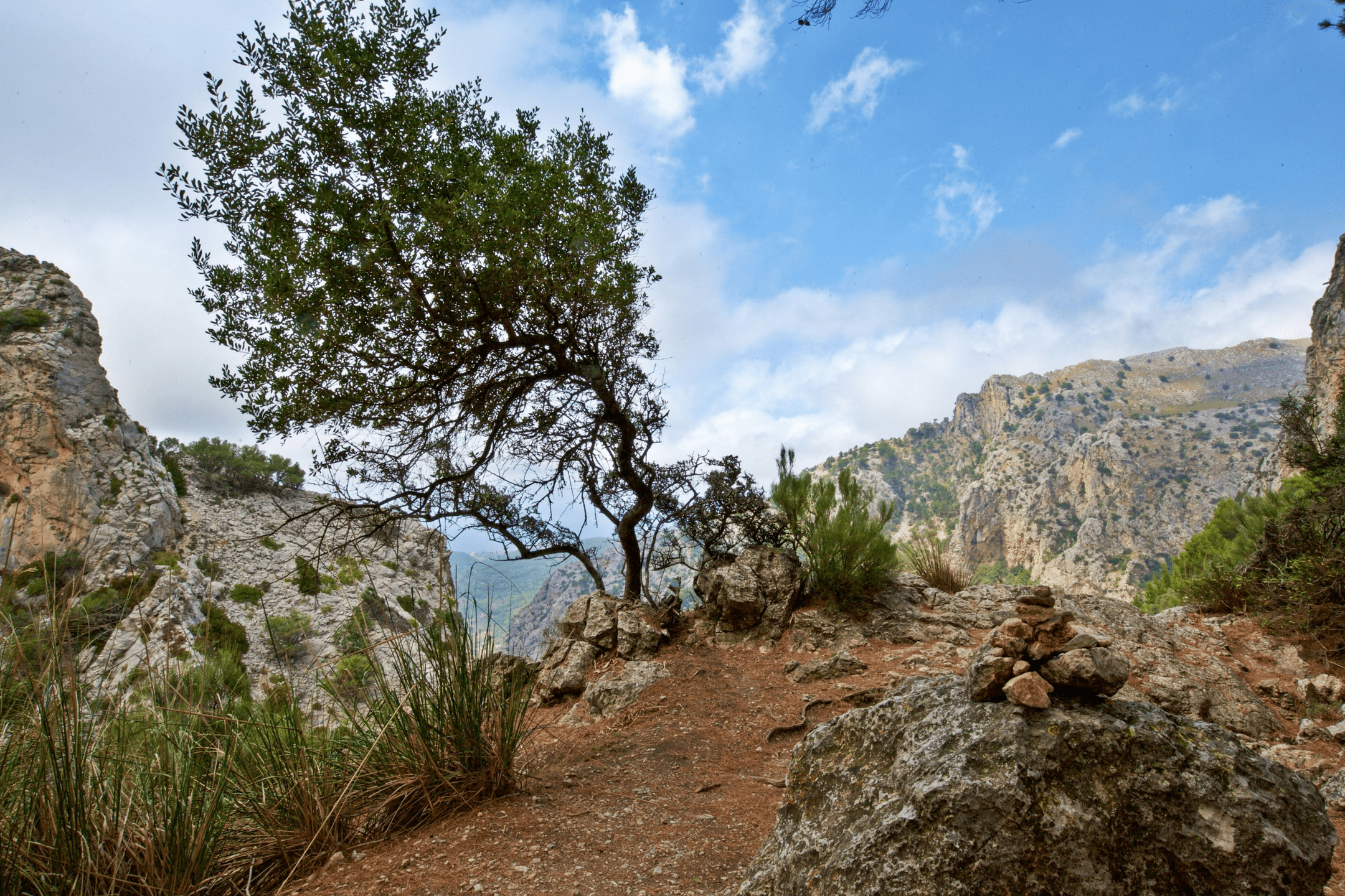
You’ll walk from La Trapa, near Andratx in the south-west of the island, to Port de Pollença in the north-east, and each stage is a day’s walk. On the way, there are olive groves and the mountain villages of Esporles and Deià.
The fourth night is at the Muleta refuge, a former telegraph station on the coast near Port de Sóller. If you’d like to try a day walk, the stage from Deià to Muleta is one of the easiest, at about 10km along the coast. The day after Muleta is the longest of the eight, at nearly 28km to the Tossals Verds refuge.
For accommodation, you can stay in hotels and guesthouses in villages like Deià and Sóller. There are also mountain refuges along the route, run by the Consell de Mallorca, with shared bunk rooms and a set dinner. You can mix the two, but at Tossals Verds the refuge is the only option, as it’s deep in the mountains.
TripJuggler Tip
If you’re walking the full route in spring, book the Tossals Verds refuge as soon as you’ve picked your dates, as beds often fill up weeks ahead.
Mount Teide
The Mount Teide hike is an 8.9km one-way climb on Tenerife to the summit of Teide, at 3,715 metres, and you can take the cable car back down.
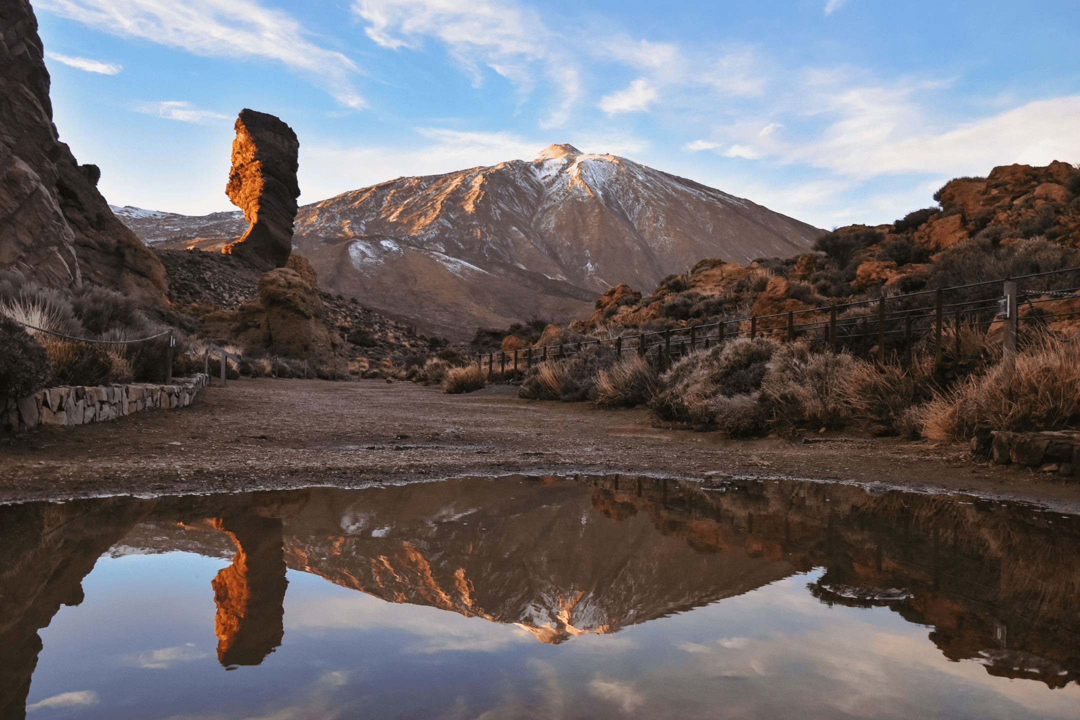
You’ll start at the Montaña Blanca viewpoint on the TF-21, the road across the national park. Along the way, you’ll pass the Huevos del Teide, or Teide’s eggs, which are giant balls of black lava from the volcano. After the track ends, the climb is very steep until you reach the Altavista refuge, a mountain hut at 3,260 metres where you can stay the night. From the refuge, it’s a gentler walk to La Rambleta, the stop at the top of the cable car.
The last part of climbing Mount Teide is a 40-minute walk up the Telesforo Bravo path from La Rambleta to the summit. Near the top, steam comes out of cracks in the rock, and you’ll smell sulphur from the volcano. The air is thin up there, and it’s normal to feel tired or a little dizzy. From the summit, you’ll walk back to La Rambleta and take the cable car down to the road.
You’ll need two permits, one for the path up and one for the summit, and you can book both up to 56 days ahead on Tenerife ON. You’ll also need to buy a cable car ticket for the way down on the Volcano Teide website before you set off.
When is the best time to go hiking in Spain?
The best time to go hiking in Spain is between June and September for mountain walks like Monte Perdido and Mulhacén, and in spring or autumn in the south and east.
On Mulhacén, July and August are the most reliable months, because in some years the snow lasts into July. On Monte Perdido, La Escupidera is often icy in June, and the summit is best climbed between July and September. The Lagos de Saliencia and the Cares Gorge are good to walk between May and October, and Peñalara, north of Madrid, is best between June and October.
In July and August, it’s too hot for long walks in the south and east. There’s little shade on Montserrat or on much of the GR221, and the climb up Puig Campana is hard in the heat.
Spring and autumn are the best seasons for the GR221 and Puig Campana, when it’s mild enough to walk all day. In Tenerife, Mount Teide is best between April and November.
In winter, there’s snow and ice on Mulhacén, Monte Perdido, Peñalara and the Lagos de Saliencia, and those walks are better suited to experienced hikers. Teide’s summit paths close when they’re icy, which often happens between December and February. Winter is also the rainiest time of year in Tenerife.
For a winter walk, we’d pick the Caminito del Rey or Puig Campana, and winters on Montserrat are mild too. The Caminito can close at short notice because of strong wind or heavy rain, and you’ll get an email if it does.
What do you need to book before walking in Spain?
Before walking in Spain, you’ll need to book tickets for the Caminito del Rey and permits for Mount Teide, as places are limited on both. If you’re staying overnight on Monte Perdido or walking the full GR221, there’s also a mountain refuge to book.
TripJuggler Tip
Book the Caminito del Rey and Mount Teide first, then plan the rest of your trip around those dates. You can build your itinerary yourself for free on TripJuggler, or have TripJuggler build it for £9.99.
FAQs about hiking in Spain
What is the most famous hike in Spain?
The best known of all the famous hikes in Spain is the Camino de Santiago, a network of pilgrimage routes to the cathedral in Santiago de Compostela. In 2025, the Pilgrim’s Office in Santiago gave out 530,919 Compostelas, the certificate for completing the Camino.
What is the highest mountain in Spain?
The highest mountain in Spain is Mount Teide on Tenerife, at 3,715 metres, and its summit is the highest point in Spain. Teide’s height is often quoted as 3,718 metres, but Spain’s National Geographic Institute gives 3,715. On mainland Spain, the highest mountain is Mulhacén in the Sierra Nevada, at 3,479 metres.
What is the most beautiful hike in Spain?
For us, the most beautiful hike in Spain is the Lagos de Saliencia, in Somiedo Natural Park in Asturias. There are four glacial lakes on the loop, high in the Cantabrian Mountains, and we adored it.
Is the Caminito del Rey a hard walk?
No, we found the Caminito del Rey an easy walk, with about 100 metres of climbing, and much of it is downhill. There are handrails along the boardwalks, and everyone is given a hard hat to wear at the start.
Does Barcelona have hikes?
Yes, and our pick is Montserrat, an easy day trip from the city. For hiking Montserrat from Barcelona, take the R5 train from Plaça Espanya to Monistrol de Montserrat, then the rack railway up to the monastery, which takes about 90 minutes in total. On the edge of the city, Collserola Natural Park has paths up to Tibidabo, its tallest point.
Which Camino is best for beginners?
The best Camino for beginners is the Camino Francés from Sarria, a walk of about 111km to Santiago that takes six or seven days. It’s long enough to earn the Compostela, which requires at least 100km on foot, and it’s well waymarked all the way. Sarria is also the most popular place to start, and 31% of pilgrims set off from there in 2025.